
Uncrewed Surface Vessel (USV)
Autonomous Survey Platform for Safe and Efficient Hydrographic Data Collection
Introduction
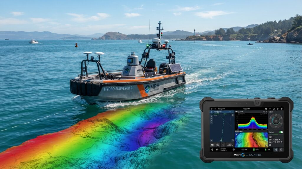
An Uncrewed Surface Vessel (USV) is a remotely operated or autonomous survey boat designed to collect hydrographic and geophysical data without requiring personnel onboard. Equipped with advanced survey sensors and precise GNSS positioning systems, USVs provide a safe, efficient, and cost-effective solution for surveying rivers, lakes, reservoirs, ports, harbors, coastal waters, and offshore environments.
USVs are increasingly used in modern hydrographic surveying because they can operate in shallow water, hazardous areas, and locations where conventional survey vessels may not be practical.
What is a USV?
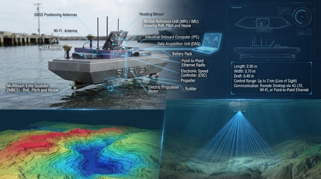
A USV (Uncrewed Surface Vessel) is a compact survey platform that navigates across the water surface while carrying hydrographic survey equipment. It can be controlled remotely by an operator or follow a pre-programmed survey route using autonomous navigation software.
The vessel continuously records accurate positioning and hydrographic data, allowing surveyors to produce reliable bathymetric maps and underwater models with minimal human intervention.
How Does a USV Work?
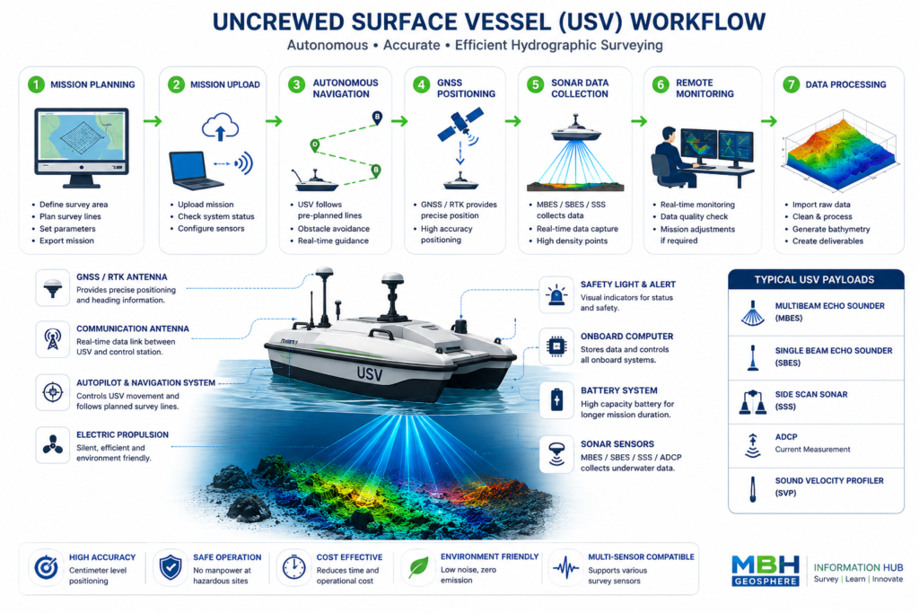
Step 1 – Survey Planning
Survey lines are designed using hydrographic survey software.
Step 2 – Mission Upload
The survey mission is uploaded to the USV navigation system.
Step 3 – Autonomous Navigation
The USV follows the planned survey route using GNSS and onboard navigation systems.
Step 4 – Data Collection
Survey sensors such as MBES, SBES, ADCP, or Side Scan Sonar collect underwater data while the vessel moves along the survey lines.
Step 5 – Real-Time Monitoring
Operators monitor the mission remotely from a control station and can adjust the survey if required.
Step 6 – Data Processing
The collected data is processed using hydrographic software to generate bathymetric maps, seabed models, and engineering reports.
Main Components
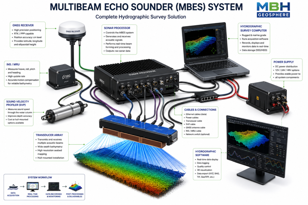
USV Platform
Electric or Hybrid Propulsion System
GNSS / RTK Receiver
Autopilot Navigation System
Communication Antenna
Survey Computer
Battery System
Remote Control Station
Payload Mounting Frame
Hydrographic Sensor
Compatible Survey Sensors
A USV can carry a wide range of survey equipment, including:
Single Beam Echo Sounder (SBES)
Multibeam Echo Sounder (MBES)
Side Scan Sonar (SSS)
Acoustic Doppler Current Profiler (ADCP)
Sound Velocity Profiler (SVP)
GNSS / RTK Receiver
LiDAR (Selected Models)
Water Quality Sensors
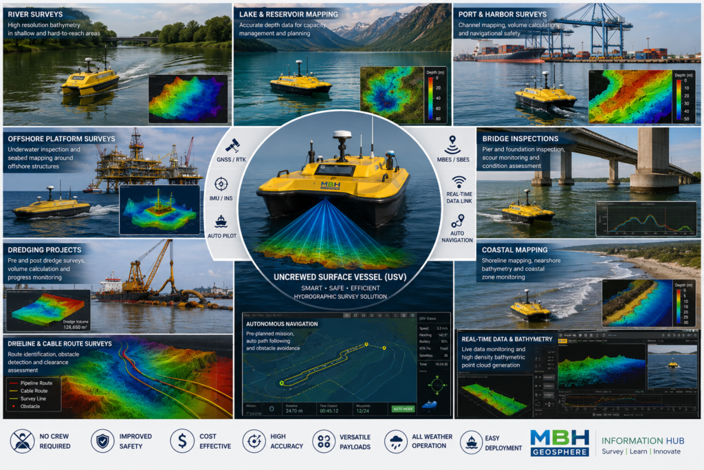
Applications
USVs are commonly used for:
Hydrographic Surveys Bathymetric Mapping
Port and Harbor Surveys
River Surveys
Lake Surveys
Reservoir Surveys
Dredging Surveys
Offshore Inspections
Coastal Engineering
Environmental Monitoring
Pipeline and Cable Route Surveys
Dam and Bridge Inspections
Advantages
No crew required onboard
Improves safety in hazardous environments
Suitable for shallow waters
Reduces survey costs
High positioning accuracy
Quiet electric operation
Easy transport and deployment
Efficient data collection
Limitations
Limited battery endurance
Performance may be affected by rough sea conditions
Requires stable communication for remote operation
Payload capacity depends on vessel size
Popular USV Models
OceanAlpha SL20
OceanAlpha SL40
CHCNAV Apache 3
CHCNAV Apache 4
Seafloor EchoBoat
Maritime Robotics Otter
Ocean Alpha M40P
Typical Technical Specifications
| Parameter | Typical Value |
|---|---|
| Length | 1–4 meters |
| Speed | Up to 6 m/s (model dependent) |
| Navigation | GNSS / RTK |
| Control | Remote or Autonomous |
| Power | Lithium Battery |
| Endurance | 4–12 Hours |
| Payload | Hydrographic Survey Sensors |
Typical Survey Workflow
Mission Planning
Equipment Installation
GNSS Calibration
Sensor Configuration
Autonomous Survey Mission
Real-Time Monitoring
Data Collection
Quality Control
Data Processing
Final Survey Report
Frequently Asked Questions
What is a USV used for?
A USV is used to perform hydrographic surveys, bathymetric mapping, environmental monitoring, and marine inspections without requiring personnel onboard.
Can a USV carry different survey sensors?
Yes. Most USVs are designed to support multiple payloads, including SBES, MBES, Side Scan Sonar, ADCP, and water quality sensors.
Why are USVs becoming popular?
USVs improve safety, reduce operational costs, and allow surveyors to collect accurate data in shallow, remote, or hazardous environments.
Related Equipment
Multibeam Echo Sounder (MBES)
Single Beam Echo Sounder (SBES)
Side Scan Sonar (SSS)
ADCP
GNSS / RTK Receiver
Survey Software