



Base Stations
A GNSS Base Station is a fixed reference receiver installed at a precisely known location that continuously tracks satellite signals and generates correction data. These corrections are transmitted to GNSS rover receivers, enabling Real-Time Kinematic (RTK) and Post-Processed Kinematic (PPK) surveys with centimeter-level accuracy.
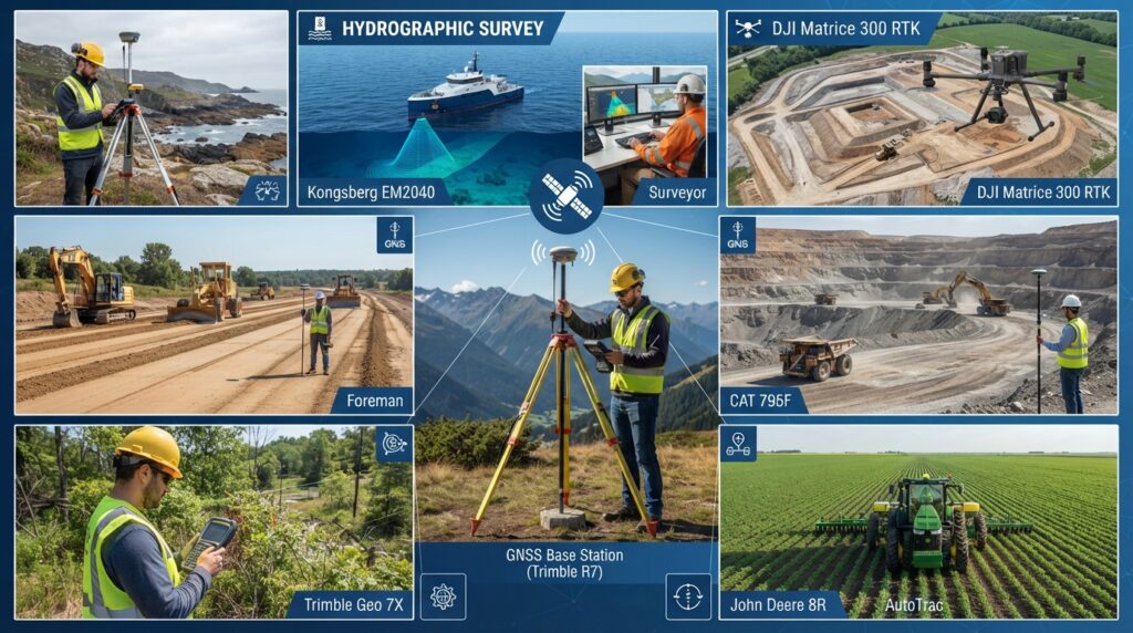
GNSS base stations are widely used in land surveying, construction, mapping, hydrographic surveying, mining, precision agriculture, and infrastructure development where highly accurate positioning is essential.
Key Components
- Transceiver: Handles the transmission and reception of signals.
- Antenna: Radiates and receives radio waves.
- Controller: Manages the communication between the base station and the network.
Importance in Surveying
In surveying, a base station provides a known reference point for GNSS (Global Navigation Satellite System) receivers, allowing for high-precision positioning through techniques like RTK (Real-Time Kinematic).
What is a GNSS Base Station?
A GNSS Base Station acts as a permanent reference point. Since its exact coordinates are known, it calculates positioning errors from GNSS satellites and sends correction data to nearby rover receivers.
This significantly improves positioning accuracy from several meters to just a few centimeters.
How Does a Base Station Work?
The operation follows a simple workflow:
- Receives signals from multiple GNSS satellites.
- Compares received positions with known coordinates.
- Calculates positioning errors.
- Generates correction data.
- Sends corrections via radio, UHF, or Internet (NTRIP).
- Rover receiver applies corrections.
- Achieves centimeter-level positioning accuracy.
Types of Base Stations
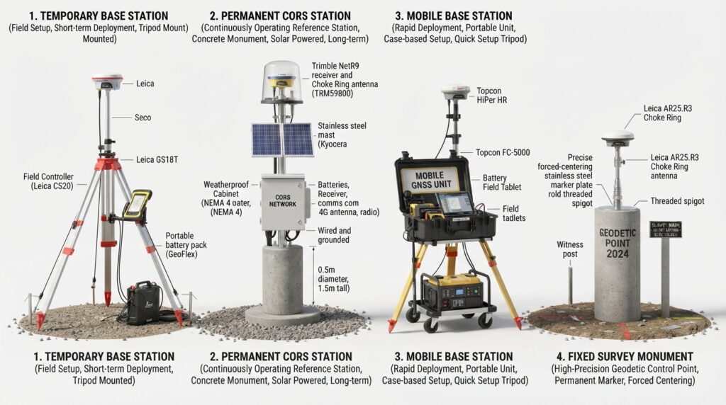
Temporary Base Station
Installed only during a survey project.
Permanent Base Station
Continuously operating reference station.
CORS Station
Continuously Operating Reference Station providing correction services over a wide region.
Mobile Base Station
Portable system used for small and medium survey projects.
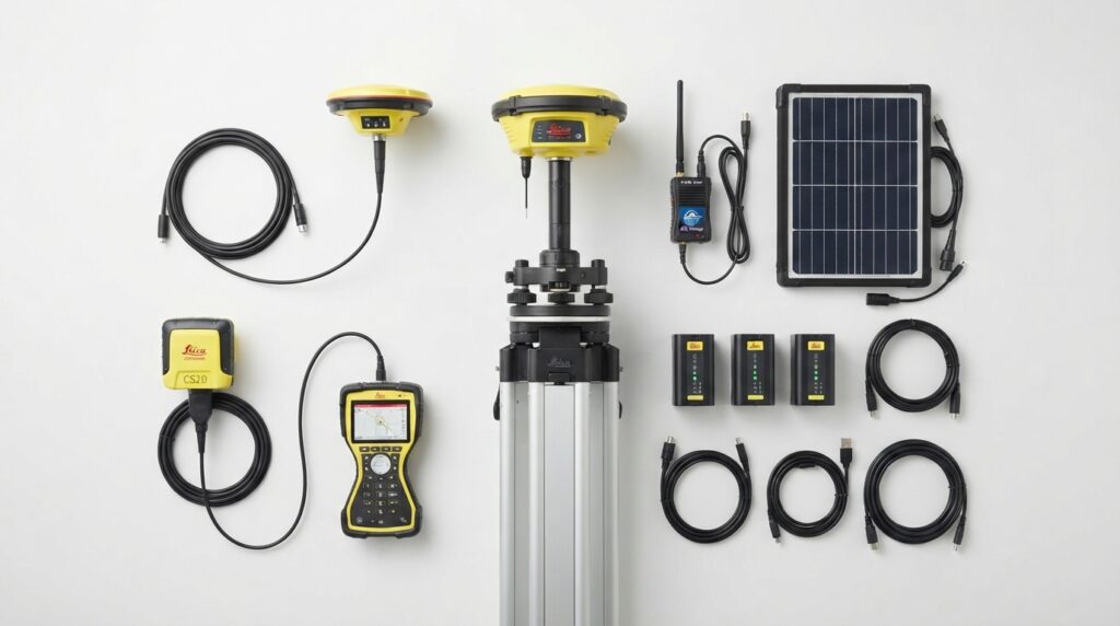
Common Equipment Used
- GNSS Antenna
- GNSS Receiver
- Survey Tripod
- Tribrach
- Survey Pole
- Radio Modem
- NTRIP Modem
- Solar Panel
- Battery System
- Controller
- Data Logger
Advantages
- Centimeter-Level Accuracy
- Real-Time Corrections
- Faster Survey Operations
- Improved Productivity
- Reduced Human Error
- High Reliability
- Supports Multiple GNSS Constellations
- Long-Distance Coverage
- Cost Effective
- Professional Survey Accuracy
-
Industries Using GNSS Base Stations
- Surveying
- Construction
- Marine Engineering
- Oil & Gas
- Renewable Energy
- Mining
- Transportation
- Government Mapping
- Agriculture
- Infrastructure Development
Frequently Asked Questions
What is a GNSS Base Station?
A fixed survey receiver that provides correction data for high-accuracy positioning.
What accuracy does a Base Station provide?
Typically 1–3 cm horizontal accuracy under good conditions.
What is the difference between RTK and Base Station?
A Base Station generates correction data, while RTK is the positioning technique that uses those corrections.
Can one Base Station support multiple rovers?
Yes. A single Base Station can provide corrections to multiple GNSS rovers simultaneously.
-
Learn More About High-Precision Surveying
Explore our educational resources covering GNSS, RTK, CORS, Total Stations, Hydrographic Surveying, GIS Mapping, and modern engineering technologies.
Learn More In MBH GeoSphere

RTK Base Station
An RTK Base Station is a fixed GNSS reference receiver installed at a known location. It continuously receives satellite signals, calculates positioning errors, and broadcasts real-time correction data to RTK rover receivers. This enables centimeter-level positioning accuracy for surveying, mapping, construction, hydrographic, and engineering applications.

Leading RTK Base Station Manufacturers
The global surveying industry relies on trusted manufacturers that develop high-precision GNSS and RTK Base Station technology for engineering, mapping, construction, marine, and geospatial applications.
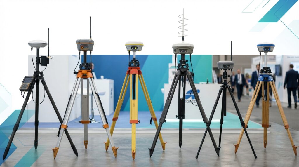
- Leading Brands
- Leica Geosystems
- Trimble
- Topcon Positioning Systems
- Hexagon
- CHCNAV
- Hi-Target
- South Surveying & Mapping
- ComNav Technology
- Stonex
- Emlid
- Septentrio
- GeoMax
- SatLab Geosolutions
- Hemisphere GNSS
- Carlson Software (GNSS Solutions)