
Dredging Survey Measuring the Seabed Before, During, and After Dredging
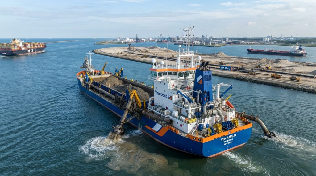
Introduction
Dredging is an important activity carried out in rivers, ports, harbors, canals, reservoirs, and coastal areas. Over time, sand, silt, mud, and other sediments build up on the seabed, making waterways shallow and reducing the safe movement of ships and boats. Dredging removes these materials to restore or increase water depth.
Before any dredging project begins, engineers need accurate information about the seabed. They also need to monitor the progress of dredging and confirm that the required depth has been achieved after the work is complete. This process is known as a Dredging Survey.
A dredging survey provides reliable measurements that help engineers plan the project, monitor excavation, calculate dredged volumes, and verify the final results. These surveys improve project accuracy, reduce unnecessary excavation, and help contractors meet design requirements.
What is a Dredging Survey?

A dredging survey is a hydrographic survey carried out before, during, and after dredging operations. It measures the seabed using modern survey equipment such as Single Beam Echo Sounders, Multibeam Echo Sounders, GNSS receivers, and survey software.
The collected data is used to create seabed maps, calculate dredged material volumes, compare design levels with actual depths, and prepare progress reports for project owners and contractors.

Why is a Dredging Survey Important?
Accurate survey data helps engineers understand existing seabed conditions before dredging starts. During construction, it allows project teams to monitor excavation progress and ensure that work follows the approved design. After dredging is completed, the survey confirms that the required depth has been achieved and calculates the total quantity of material removed.
Without regular dredging surveys, projects may remove too much or too little material, leading to higher costs, project delays, navigation problems, and possible contract disputes.

Where are Dredging Surveys Used?
Dredging surveys are carried out in ports, harbors, navigation channels, rivers, lakes, reservoirs, coastal development projects, offshore construction sites, reclamation projects, marinas, shipyards, and flood control projects. They are also used to maintain existing waterways and improve safe navigation for commercial vessels.
Did You Know?

Modern dredging surveys can calculate excavation volumes with high accuracy by comparing seabed models collected before and after dredging. This helps contractors verify completed work and supports accurate project reporting.

Coastal Protection

Port Expansion
Wetland Restoration
Quick Facts
| Feature | Details |
|---|
| Survey Type | Hydrographic Survey |
| Main Purpose | Monitor Dredging Operations |
| Common Equipment | SBES, MBES, GNSS, Survey Vessel |
| Main Output | Seabed Maps, Volume Calculations, Progress Reports |
| Industries | Ports, Offshore, Coastal Engineering, Marine Construction |
Frequently Asked Questions
What is a Dredging Survey?
A dredging survey is a hydrographic survey carried out before, during, and after dredging operations. It measures water depth, maps the seabed, monitors excavation progress, and calculates the volume of material removed.
Why is a Dredging Survey Important?
A dredging survey ensures that the required depth is achieved while avoiding unnecessary excavation. It helps improve project accuracy, supports contractor payments, and confirms that the work meets the project specifications.
What Equipment is Used in a Dredging Survey?
Common equipment includes a Survey Vessel, Single Beam Echo Sounder, Multibeam Echo Sounder, GNSS Receiver, Motion Sensor, Tide Gauge, Hydrographic Survey Software, and Survey Computer. Together, these systems collect accurate bathymetric and positioning data.
What is the Difference Between a Pre Dredge Survey and a Post Dredge Survey?
A Pre Dredge Survey records the original seabed condition before dredging begins. A Post Dredge Survey is completed after the work finishes to verify that the required design depth has been achieved and to confirm project completion.
How is the Dredging Volume Calculated?
The dredging volume is calculated by comparing seabed models collected before and after dredging. Hydrographic software calculates the difference between the two surfaces to determine the quantity of material removed.
Where are Dredging Surveys Used?
Dredging surveys are used in ports, harbors, rivers, canals, reservoirs, navigation channels, marinas, coastal development projects, land reclamation works, offshore construction sites, and flood control projects.
How Accurate is a Dredging Survey?
Modern dredging surveys provide highly accurate results when calibrated equipment, precise GNSS positioning, and proper survey methods are used. Good weather conditions and quality data processing also improve the final accuracy.
Maintenance of Survey Equipment
Hydrographic survey equipment should be cleaned after every survey to remove salt, mud, and marine growth. Echo sounders, GNSS receivers, motion sensors, and other instruments should be inspected regularly for damage or loose connections. Routine calibration, software updates, and proper storage help maintain reliable performance and extend the life of the equipment.
Safety During Dredging Surveys
Survey operations should begin only after checking weather forecasts, tidal conditions, and navigation warnings. All equipment must be securely installed before data collection starts. Crew members should wear appropriate personal protective equipment and follow safe lifting procedures when handling survey instruments. Survey data should be backed up throughout the project to prevent information loss.