
What is Photogrammetry?
Learn How Photographs Become Accurate Survey Data
Photogrammetry is a modern surveying method that uses photographs to measure distances, create maps, generate 3D models, and capture accurate information about the Earth’s surface. It is widely used in land surveying, construction, mining, engineering, agriculture, and infrastructure development.
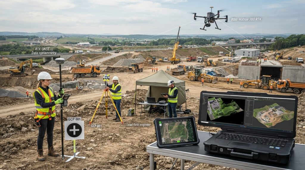
What is Photogrammetry?
Photogrammetry is the science of collecting accurate measurements and creating maps or 3D models from photographs.
Instead of measuring every point with traditional survey equipment, surveyors capture many overlapping photographs using a drone, aircraft, satellite, or digital camera. These images are processed with specialized software to calculate the exact position of millions of points and create highly accurate digital models.
Today, photogrammetry is one of the most important technologies used in surveying and mapping because it allows large areas to be measured quickly and safely.
Why is Photogrammetry Important?
Modern engineering projects require detailed and accurate information before construction begins.
Photogrammetry allows surveyors to collect thousands of measurements from photographs in a short time. It reduces fieldwork, improves safety, and provides accurate digital data for planning, design, and construction.
It is especially useful for surveying areas that are difficult, dangerous, or impossible to reach on foot.
How Does Photogrammetry Work?
The process begins by capturing many overlapping photographs of the survey area.
Each photograph contains common features that appear in multiple images. Photogrammetry software identifies these matching points and calculates their exact position in three-dimensional space.
The software then combines all the photographs to create digital products such as orthomosaic maps, dense point clouds, Digital Surface Models (DSM), Digital Terrain Models (DTM), contour maps, and realistic 3D models.
Where is Photogrammetry Used?
Photogrammetry is used in many industries, including:
- Land Surveying
- Construction Projects
- Road and Highway Design
- Railway Engineering
- Mining and Quarrying
- Coastal Mapping
- Dredging Projects
- Agriculture
- Forestry
- Archaeology
- Environmental Monitoring
- Urban Planning
- Disaster Assessment
- Infrastructure Inspection
What Can Photogrammetry Produce?
Photogrammetry can create many useful digital products, including:
- Orthomosaic Maps
- 3D Models
- Dense Point Clouds
- Digital Surface Models (DSM)
- Digital Terrain Models (DTM)
- Contour Maps
- Elevation Models
- Volume Calculations
- Surface Measurements
These products help engineers make better decisions throughout a project.
Advantages of Photogrammetry
Photogrammetry offers many benefits. It can survey large areas quickly, reduce field time, improve safety, produce highly detailed maps, create realistic 3D models, and provide accurate measurements for engineering projects. It is also a cost-effective solution for projects that require frequent site monitoring.
Equipment Used in Photogrammetry
A typical photogrammetry survey may use:
- Survey Drone (UAV)
- Digital Camera
- RTK GNSS Receiver
- Ground Control Points (GCPs)
- Survey Targets
- Drone Controller
- Flight Planning Software
- Photogrammetry Processing Software
- High-Performance Computer
Who Uses Photogrammetry?
Photogrammetry is commonly used by survey engineers, civil engineers, GIS specialists, drone pilots, mining engineers, construction companies, environmental consultants, archaeologists, urban planners, and government mapping agencies.
Conclusion
Photogrammetry has transformed the way survey data is collected and processed. By combining high-quality photographs with advanced software, it allows engineers and surveyors to create accurate maps, 3D models, and terrain information quickly and efficiently. Whether you are a beginner or an experienced professional, understanding photogrammetry is essential for working with modern geospatial technology.