
Leading Photogrammetry Software, Cameras and Manufacturers
Explore the World's Leading Photogrammetry Solutions
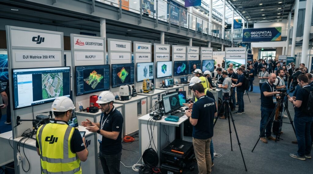
Professional photogrammetry projects require reliable drones, cameras, and software to produce accurate maps, point clouds, and 3D models. This guide introduces the most trusted manufacturers and software used by surveyors around the world.
Introduction
The quality of a photogrammetry project depends on both the equipment used to capture images and the software used to process them.
Modern drones, high-resolution cameras, and advanced processing software allow surveyors to create accurate orthomosaics, terrain models, point clouds, and realistic 3D models for engineering projects.
Choosing the right solution depends on the project size, required accuracy, workflow, and budget.
DJI
DJI is one of the world’s leading manufacturers of professional survey drones. Its RTK drones are widely used for mapping, construction, mining, agriculture, and infrastructure inspection.
Popular Products
- Matrice 350 RTK
- Matrice 4E
- Phantom 4 RTK
- Mavic 3 Enterprise
Best For
- Land Survey
- Construction
- Mining
- Infrastructure Inspection
- Agriculture
Leica Geosystems
Leica Geosystems provides complete photogrammetry solutions including cameras, GNSS equipment, scanners, and processing software for high-accuracy surveying.
Popular Products
- Leica BLK2FLY
- Leica GS Series GNSS
- Leica Pegasus
- Leica Infinity
Best For
- Engineering Survey
- Reality Capture
- Infrastructure
- BIM
- GIS
Trimble
Trimble develops professional geospatial hardware and software for surveying, mapping, and construction.
Popular Products
- Trimble SX12
- Trimble MX Series
- Trimble Business Center
Best For
- Surveying
- Construction
- Mapping
- Machine Control
Topcon
Topcon provides advanced positioning systems and photogrammetry solutions for surveying and construction industries.
Popular Products
- Topcon CR Series
- Topcon GT Series
- Topcon MAGNET Software
Best For
- Surveying
- Construction
- Civil Engineering
Wingtra
Wingtra manufactures fixed-wing VTOL drones capable of covering very large survey areas with high efficiency.
Popular Products
- WingtraOne GEN II
Best For
- Large Mapping Projects
- Mining
- Agriculture
- Corridor Surveys
Agisoft
Agisoft develops one of the most widely used photogrammetry software packages for creating point clouds, orthomosaics, and 3D models.
Popular Products
- Agisoft Metashape Professional
Best For
- 3D Modeling
- Mapping
- Archaeology
- Surveying
Pix4D
Pix4D is a professional photogrammetry software widely used for drone mapping and engineering applications.
Popular Products
- Pix4Dmapper
- Pix4Dmatic
- Pix4Dsurvey
Best For
- Drone Mapping
- Construction
- Mining
- Surveying
Bentley Systems
Bentley provides enterprise-level reality modeling software for large infrastructure and engineering projects.
Popular Products
- ContextCapture
Best For
- Smart Cities
- Railways
- Highways
- Large Infrastructure
Esri
Esri combines GIS technology with drone mapping to support spatial analysis and asset management.
Popular Products
- ArcGIS Drone2Map
- ArcGIS Site Scan
Best For
- GIS
- Mapping
- Government Projects
- Environmental Studies
RealityCapture
RealityCapture is known for processing very large image datasets quickly and producing high-quality 3D models.
Popular Products
- RealityCapture
Best For
- Reality Modeling
- Digital Twins
- Large 3D Projects
OpenDroneMap
OpenDroneMap is an open-source photogrammetry platform that provides drone image processing without expensive licensing costs.
Popular Products
- WebODM
- OpenDroneMap
Best For
- Education
- Research
- Small Survey Projects
- Budget-Friendly Mapping
How to Choose the Right Photogrammetry Solution
The best solution depends on your project requirements.
For small drone surveys, DJI drones combined with Pix4D or Agisoft Metashape provide an efficient workflow.
For high-accuracy engineering and infrastructure projects, Leica Geosystems and Trimble offer advanced surveying solutions with professional-grade hardware and software.
For large-scale mapping projects, Wingtra fixed-wing drones are ideal because they can cover extensive areas in a single flight.
If you require enterprise-level reality modeling, Bentley ContextCapture and RealityCapture are excellent choices. For organizations looking for a cost-effective solution, OpenDroneMap provides a capable open-source alternative.
Always compare accuracy requirements, camera quality, software features, processing speed, hardware compatibility, technical support, and long-term project needs before selecting a photogrammetry solution.
Conclusion
Photogrammetry has become an essential technology in modern surveying, mapping, and engineering. Leading manufacturers continue to improve drones, cameras, and processing software to deliver faster workflows and more accurate results. Selecting the right combination of equipment and software helps surveyors produce reliable maps, detailed point clouds, and realistic 3D models for projects of every size.