
What is an RTK Rover?
The Mobile Receiver That Collects Accurate Survey Data
An RTK Rover is a portable GNSS receiver used to collect accurate survey points in the field. It receives real-time correction data from an RTK Base Station or a CORS network, allowing surveyors to measure positions with centimeter-level accuracy for construction, mapping, and engineering projects.
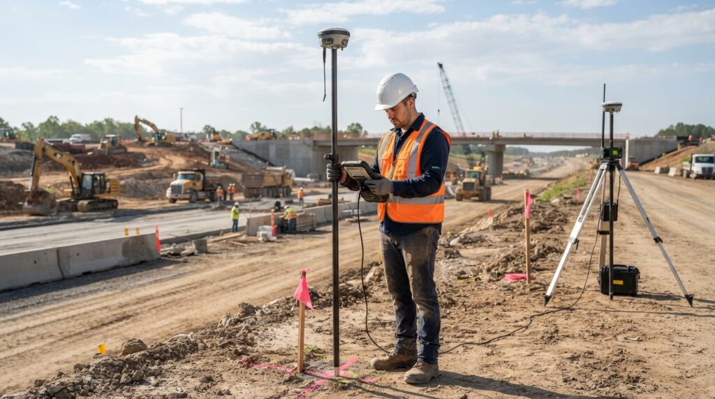
What is an RTK Rover?
An RTK Rover is a portable GNSS receiver that surveyors carry to different locations during a survey. Unlike the Base Station, which remains fixed on a known point, the Rover moves around the project site to measure new points.
The Rover receives satellite signals and combines them with correction data from an RTK Base Station or a CORS network. This process improves positioning accuracy and allows surveyors to collect highly accurate coordinates in real time.
RTK Rovers are widely used because they provide fast, reliable, and precise survey results.
Why is an RTK Rover Important?
An RTK Rover allows surveyors to measure points quickly without sacrificing accuracy. It is designed to work in real time, making it possible to complete surveys faster than many traditional methods.
Because the Rover receives correction data continuously, engineers can trust that the measured coordinates are accurate enough for construction, mapping, and infrastructure projects.
How Does an RTK Rover Work?
The RTK Rover receives signals from GNSS satellites while also receiving correction data from an RTK Base Station or a CORS network.
The built-in receiver combines both sources of information and calculates an accurate position within a few seconds.
The surveyor uses the Rover to measure points, record coordinates, stake out designs, and collect field data for different engineering projects.
Main Parts of an RTK Rover
A complete RTK Rover usually includes:
- GNSS Receiver
- GNSS Antenna
- Survey Pole
- Survey Controller
- Internal Radio or Internet (NTRIP) Communication
- Rechargeable Battery
All of these components work together to provide accurate positioning in the field.
Where is an RTK Rover Used?
RTK Rovers are used in many surveying and engineering projects, including:
- Land Surveys
- Construction Projects
- Topographic Surveys
- Boundary Surveys
- Road and Highway Projects
- Railway Surveys
- Utility Mapping
- Bridge Construction
- Mining
- Agriculture
- GIS Data Collection
- Drone Ground Control Surveys
Advantages of an RTK Rover
An RTK Rover offers many benefits for modern surveying. It provides centimeter-level accuracy, delivers results in real time, reduces fieldwork time, improves productivity, and allows surveyors to collect reliable data efficiently. It is lightweight, easy to carry, and suitable for a wide range of engineering applications.
RTK Rover vs RTK Base Station
Although both devices are part of an RTK survey, they have different roles.
The RTK Base Station remains fixed on a known point and sends correction data.
The RTK Rover moves throughout the survey area and receives those corrections to measure accurate coordinates.
Both devices work together to achieve precise survey results.
Common Applications
RTK Rovers are commonly used for:
- Control Surveys
- Construction Layout
- Topographic Mapping
- Boundary Surveys
- Utility Surveys
- Road Construction
- Bridge Projects
- GIS Mapping
- Agriculture
- Machine Control
Frequently Asked Questions
Can an RTK Rover work without a Base Station?
Yes. An RTK Rover can also receive correction data from a CORS network through an internet connection. If neither a Base Station nor a CORS network is available, the positioning accuracy will be lower.
How accurate is an RTK Rover?
When connected to an RTK Base Station or a CORS network, an RTK Rover can typically achieve 1 to 3 centimeters of horizontal and vertical accuracy under good survey conditions.
Can one Base Station support multiple Rovers?
Yes. A single RTK Base Station can provide correction data to multiple RTK Rovers at the same time.
Conclusion
An RTK Rover is an essential tool in modern surveying. It allows surveyors to collect accurate field measurements quickly by receiving real-time correction data from an RTK Base Station or a CORS network. Its speed, accuracy, and ease of use make it one of the most widely used surveying instruments in engineering and construction projects.