
What is a Total Station?
One Instrument That Measures Distance, Angles, and Coordinates
A Total Station is one of the most important instruments used in modern land surveying. It measures horizontal angles, vertical angles, distances, and coordinates with high accuracy. It helps surveyors complete projects faster and with greater precision.
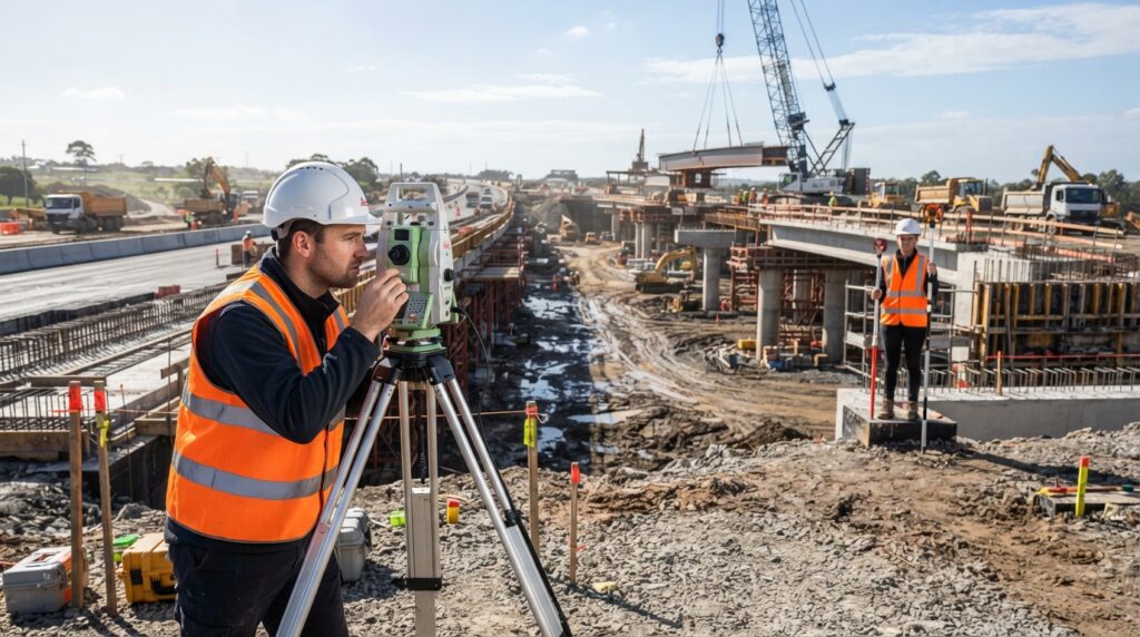
What is a Total Station?
A Total Station is an electronic surveying instrument used to measure angles, distances, and coordinates. It combines an Electronic Distance Measurement (EDM) system with a digital theodolite and an onboard computer.
Instead of using separate instruments for different measurements, a Total Station can perform many surveying tasks with a single device. This saves time and improves accuracy.
Today, Total Stations are widely used in construction, road projects, boundary surveys, topographic mapping, and engineering work.
Why is a Total Station Important?
Modern construction projects require accurate measurements. Even a small mistake can create problems during construction.
A Total Station helps surveyors measure points accurately, mark building locations, calculate coordinates, and check completed work. It improves efficiency and reduces the chances of measurement errors.
How Does a Total Station Work?
A Total Station is placed on a tripod over a known survey point.
The surveyor levels the instrument and enters the required project information.
The instrument sends a laser or infrared signal to a prism or a reflectorless target and measures the distance.
At the same time, it measures horizontal and vertical angles.
Using these measurements, the Total Station automatically calculates the coordinates of the point.
The results are displayed on the screen and can also be saved for later use.
Main Parts of a Total Station
A standard Total Station includes:
- Telescope
- Electronic Distance Measurement (EDM)
- Angle Measurement System
- Display Screen
- Keyboard
- Battery
- Tribrach
- Optical or Laser Plummet
- Data Storage System
Each part works together to provide accurate survey measurements.
Where is a Total Station Used?
Total Stations are commonly used for:
- Land Surveying
- Topographic Surveys
- Building Construction
- Road Construction
- Bridge Construction
- Railway Projects
- Boundary Surveys
- Utility Mapping
- Mining
- Tunnel Surveys
- Infrastructure Development
Advantages of a Total Station
A Total Station provides accurate measurements, saves time, stores survey data digitally, reduces manual calculations, and improves productivity. It is suitable for both small and large surveying projects.
Total Station vs Theodolite
A Theodolite measures only horizontal and vertical angles.
A Total Station measures angles, distances, and coordinates while also storing digital survey data.
Because of these additional features, a Total Station is more efficient and widely used in modern surveying.
Common Applications
A Total Station is commonly used for:
- Site Layout
- Building Setting Out
- Topographic Mapping
- Boundary Surveys
- Road Alignment
- Bridge Construction
- Earthwork Surveys
- As-Built Surveys
- Construction Monitoring
Frequently Asked Questions
Can a Total Station measure distance?
Yes. A Total Station measures both distance and angles, then automatically calculates coordinates.
Does a Total Station need a prism?
Many Total Stations can work with a prism for long-distance measurements. Some modern models also support reflectorless measurements, allowing them to measure certain points without a prism.
Is a Total Station suitable for beginners?
Yes. With proper training, beginners can learn to operate a Total Station and use it for many surveying tasks.
How accurate is a Total Station?
The accuracy depends on the model being used. Professional Total Stations provide very high accuracy, making them suitable for engineering and construction projects.
Conclusion
A Total Station is one of the most valuable instruments in modern surveying. It combines angle measurement, distance measurement, and coordinate calculation into one device. Its speed, accuracy, and ease of use make it an essential tool for surveyors working on construction, infrastructure, mapping, and engineering projects.
Related Articles
- How to Set Up a Total Station
- Leading Total Station Models and Brands
- What is an Auto Level?
- What is a GNSS Receiver?
- What is Topographic Survey?