
How to Set Up a Magnetometer
Set Up Your Magnetometer for Accurate Marine Geophysical Surveys
A properly installed Magnetometer helps survey teams detect buried pipelines, shipwrecks, anchors, cables, and other metal objects beneath the seabed. Correct setup improves data quality and survey accuracy.
Introduction
Before starting a marine geophysical survey, the Magnetometer system must be installed and tested carefully.
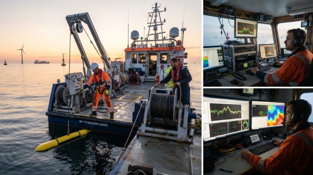
The sensor should be deployed correctly behind the survey vessel, connected to the survey computer, and positioned far enough from the vessel to avoid magnetic interference.
A proper setup allows the Magnetometer to collect reliable magnetic data throughout the survey.
Equipment Required
Before installation, prepare the following equipment:
- Marine Magnetometer
- Towfish
- Armored Tow Cable
- Hydraulic Winch
- GNSS Receiver
- GNSS Antenna
- Survey Computer
- Geophysical Survey Software
- Power Supply
- Survey Vessel
Step 1 – Inspect the Equipment
Inspect the Magnetometer, towfish, tow cable, winch, and connectors before leaving the port.
Check for damaged cables, loose connectors, or signs of water leakage.
Make sure every component is clean and ready for operation.
Step 2 – Install the Magnetometer Towfish
Attach the Magnetometer securely inside the towfish or connect it according to the manufacturer’s instructions.
Check that the tow cable is firmly connected.
The towfish should move smoothly through the water without excessive vibration.
Step 3 – Connect the Survey System
Connect the Magnetometer to the survey computer.
Verify that the GNSS receiver is connected correctly.
Open the survey software and confirm that the system detects all connected equipment.
Step 4 – Configure the Survey Software
Create a new survey project.
Enter the project coordinate system and survey settings.
Configure the Magnetometer communication port, sampling rate, and recording interval.
Enter the tow cable length and layback settings if required.
Step 5 – Deploy the Magnetometer
Slowly lower the towfish into the water.
Release enough tow cable so the Magnetometer remains well behind the survey vessel.
Keeping the sensor away from the vessel reduces magnetic interference caused by engines, steel structures, and onboard equipment.
Step 6 – Verify the Live Data
Monitor the magnetic readings on the survey computer.
The magnetic values should remain stable while the vessel moves through an area without large metal objects.
If abnormal readings appear, inspect the tow cable, sensor, and vessel equipment for possible interference.
Step 7 – Perform a System Check
Before beginning the survey, tow the Magnetometer over a known metal object if available.
Check that the recorded magnetic anomaly appears in the correct location.
This confirms that the system is operating properly.
Step 8 – Start the Survey
Navigate along the planned survey lines at a steady speed.
Monitor the magnetic data, vessel position, towfish position, and system status throughout the survey.
Record all magnetic measurements for processing after the survey.
Common Mistakes to Avoid
Do not tow the Magnetometer too close to the survey vessel.
Avoid sudden vessel turns that may cause the towfish to swing.
Do not allow the tow cable to become twisted or damaged.
Always check GNSS positioning before recording survey data.
Inspect the sensor after every deployment.
Best Practices
Maintain a constant vessel speed throughout the survey.
Keep the towfish at a consistent depth.
Check magnetic readings regularly during the survey.
Record environmental conditions in the survey log.
Back up survey data after each project.
Calibrate and service the equipment according to the manufacturer’s recommendations.
Conclusion
A properly installed Magnetometer provides accurate magnetic data for detecting buried and submerged metal objects. Careful installation, correct towfish deployment, and regular system checks help survey teams collect reliable information for offshore engineering, dredging, pipeline inspections, and marine geophysical surveys.