
Drone Survey
Discover How Drone Survey Technology is Transforming Modern Mapping
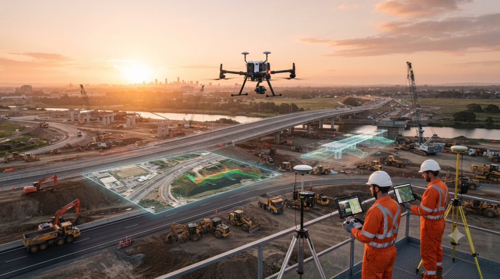
Drone Survey uses unmanned aerial vehicles (UAVs) equipped with high-resolution cameras and sensors to collect accurate aerial data. It provides a fast, safe, and efficient way to create maps, 3D models, orthophotos, and topographic surveys for engineering and construction projects.
Introduction
Drone surveying has changed the way engineers and surveyors collect data. Instead of spending days measuring large areas on the ground, a drone can capture thousands of images from the air in a short time.
Using advanced positioning technology and mapping software, these images are processed into accurate maps and three-dimensional models.
Today, drone surveys are widely used in construction, mining, land development, agriculture, road projects, railway corridors, and environmental monitoring because they save time while providing highly detailed information.
What is a Drone Survey?
A Drone Survey is a surveying method that uses an Unmanned Aerial Vehicle (UAV) equipped with cameras, GNSS receivers, and other sensors to collect aerial data.
During the flight, the drone captures overlapping photographs of the survey area. These images are processed using photogrammetry software to produce accurate orthophotos, digital elevation models, contour maps, point clouds, and 3D terrain models.
This allows engineers to measure distances, elevations, and surface features without physically accessing every part of the site.
Why is Drone Survey Important?
Many engineering projects cover large or difficult-to-reach areas.
Drone surveying makes data collection faster, safer, and more efficient. It reduces fieldwork, improves accuracy, and provides detailed aerial information that supports planning, design, construction, and progress monitoring.
Because data is collected digitally, engineers can compare surveys over time and monitor project changes more effectively.
Main Components of a Drone Survey System
A complete drone survey system includes several important components.
These include:
- Survey Drone (UAV)
- Flight Controller
- GNSS Receiver
- RTK or PPK Positioning System
- High-Resolution Camera
- LiDAR Sensor (optional)
- Multispectral Camera (optional)
- Battery System
- Remote Controller
- Ground Control Points (GCPs)
- Base Station
- Mission Planning Software
- Photogrammetry Software
- Survey Computer
All of these components work together to produce accurate survey results.
Types of Drone Surveys
Different projects require different survey methods.
This category covers:
- Topographic Survey
- Photogrammetry Survey
- LiDAR Survey
- Construction Progress Survey
- Mining Survey
- Volume Survey
- Corridor Survey
- Agricultural Survey
- Environmental Survey
- Infrastructure Inspection
Each survey type is designed for a specific application.
Where are Drone Surveys Used?
Drone surveys are commonly used in:
- Land Surveying
- Construction Projects
- Highway Projects
- Railway Projects
- Mining Operations
- Quarry Surveys
- Land Development
- Agriculture
- Forestry
- Utility Corridors
- Power Line Inspection
- Pipeline Inspection
- Coastal Mapping
- Environmental Monitoring
- Disaster Assessment
Their ability to collect detailed aerial data makes them valuable across many industries.
What You Will Learn in This Category
In this section, you will learn how drone surveys are planned, how UAVs collect aerial data, how images are processed, how accurate maps are created, and how drones are used in real engineering projects.
You will also learn about flight planning, RTK and PPK positioning, photogrammetry, LiDAR technology, safety procedures, and the leading drone manufacturers used by professional surveyors.
Who Should Read This Section?
This section is useful for:
- Survey Engineers
- Civil Engineers
- GIS Professionals
- Construction Engineers
- Mining Engineers
- Drone Pilots
- Students
- Project Managers
- Anyone interested in UAV mapping technology
Conclusion
Drone Survey has become one of the most important technologies in modern surveying. By combining UAVs, GNSS positioning, high-resolution cameras, and mapping software, engineers can collect accurate aerial data quickly and safely. Whether the project involves mapping land, monitoring construction, calculating stockpile volumes, or creating 3D models, drone surveying provides reliable information that supports better engineering decisions.