
What is a Scanner System?
Understand the Technology Behind Modern 3D Laser Scanning
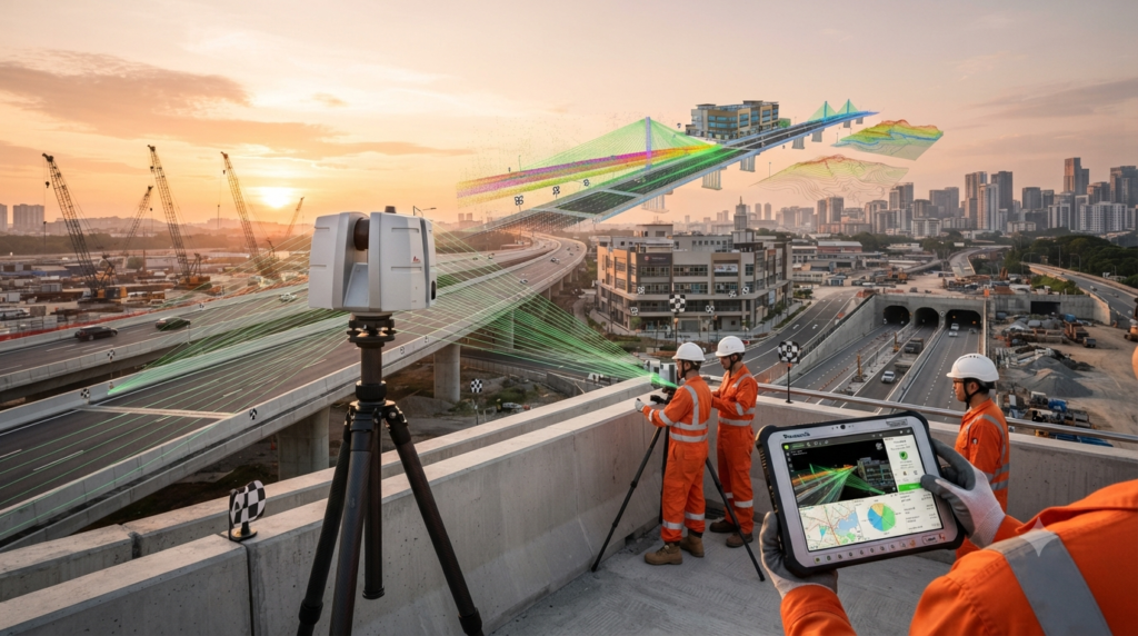
A Scanner System is one of the most advanced surveying technologies used to capture millions of accurate measurement points in a short time. It helps engineers, surveyors, architects, and construction professionals create detailed 3D models, point clouds, and digital twins of real-world environments.
Introduction
Surveying has changed significantly over the past few decades. In the past, surveyors measured one point at a time using traditional instruments. Today, a scanner system can capture an entire building, bridge, road, tunnel, or industrial plant within minutes.
Instead of collecting only a few measurement points, a scanner records millions of points across every visible surface. These points are combined to create a detailed digital representation of the real world.
Because of its speed and accuracy, laser scanning has become an important tool in construction, land surveying, mining, infrastructure development, heritage preservation, and Building Information Modeling (BIM).
What is a Scanner System?
A Scanner System is a surveying system that uses laser technology to measure the position of objects and surfaces in three dimensions.
The scanner sends out thousands or even millions of laser pulses every second. Each pulse travels to an object and returns to the scanner. By measuring the travel time or phase shift of the laser beam, the scanner calculates the exact location of each point.
The collected data is stored as a Point Cloud, which contains millions of XYZ coordinates representing the scanned environment.
This point cloud can later be converted into accurate 2D drawings, 3D models, digital terrain models, BIM models, and digital twins.
How Does a Scanner System Work?
A scanner works by rotating its laser sensor and continuously measuring everything within its field of view.
At the same time, many scanners capture high-resolution photographs. These images are combined with the point cloud to produce realistic coloured 3D models.
After the field survey is complete, the scan data is transferred to specialised software where multiple scans are registered together, cleaned, and processed into engineering deliverables.
Main Components of a Scanner System
A complete scanner system includes several important parts.
- 3D Laser Scanner
- Laser Emitter and Receiver
- Rotating Scan Head
- High-Resolution Camera
- GNSS Receiver (optional)
- IMU (Inertial Measurement Unit)
- Internal Storage
- Battery System
- Touchscreen Display
- Heavy-Duty Tripod
- Survey Targets
- Control Tablet
- Point Cloud Processing Software
- Registration Software
- BIM and CAD Software
Each component plays an important role in capturing and processing accurate survey data.
Types of Scanner Systems
Different projects require different scanning technologies.
The most common types include:
- Terrestrial Laser Scanner (TLS)
- Mobile Laser Scanner
- Handheld Laser Scanner
- SLAM Scanner
- Mobile Mapping System
- LiDAR Scanner
Each scanner is designed for specific surveying environments and project requirements.
Where are Scanner Systems Used?
Scanner systems are widely used in many industries.
They are commonly used for:
- Land Surveying
- Building Construction
- Highway Projects
- Railway Surveys
- Bridge Inspection
- Tunnel Surveys
- Mining
- Industrial Plants
- Oil and Gas Facilities
- Heritage Documentation
- BIM Projects
- As-Built Surveys
- Topographic Mapping
- Volume Calculations
- Digital Twin Creation
Their ability to collect complete 3D information makes them valuable for both small and large engineering projects.
Advantages of a Scanner System
A scanner system can collect millions of measurement points within a short period, making fieldwork much faster than traditional survey methods.
It provides highly accurate data, reduces the chance of missing important details, improves worker safety by allowing measurements from a distance, and creates a permanent digital record that can be used for future design, inspection, and maintenance.
The collected point cloud can also be used to generate 2D drawings, 3D models, BIM models, and digital twins.
Frequently Asked Questions
Is a Scanner System the same as a Total Station?
No. A total station measures individual survey points one at a time, while a scanner system captures millions of points automatically, creating a complete three-dimensional model of the surveyed area.
Can a Scanner System work indoors?
Yes. Scanner systems are commonly used inside buildings, factories, tunnels, warehouses, and industrial facilities where accurate 3D measurements are required.
Can Scanner Systems be used outdoors?
Yes. They are widely used for highways, bridges, ports, railways, mining sites, construction projects, and large topographic surveys.
Conclusion
A Scanner System has transformed modern surveying by allowing engineers to capture complete three-dimensional information quickly and accurately. Instead of measuring a few individual points, surveyors can now create detailed point clouds and digital models that improve planning, design, construction, and maintenance. As reality capture technology continues to advance, scanner systems are becoming an essential tool for surveyors, engineers, architects, and construction professionals around the world.