
Hydrographic Survey
Explore the World Beneath the Water
Explore the World Beneath the Water
Hydrographic Survey is the science of measuring and mapping underwater features to understand the depth, shape, and condition of the seabed. It provides accurate information about rivers, lakes, ports, harbors, coastal areas, and offshore environments.
Hydrographic surveys are essential for marine navigation, offshore construction, dredging, coastal engineering, environmental studies, and underwater infrastructure projects. By using advanced survey equipment and positioning systems, surveyors can create precise bathymetric maps and identify underwater hazards.
At MBH Geosphere, you can explore the principles, equipment, technologies, and applications used in modern hydrographic surveying.
Types Of Hydrographic Survey

What is Hydrographic Survey?

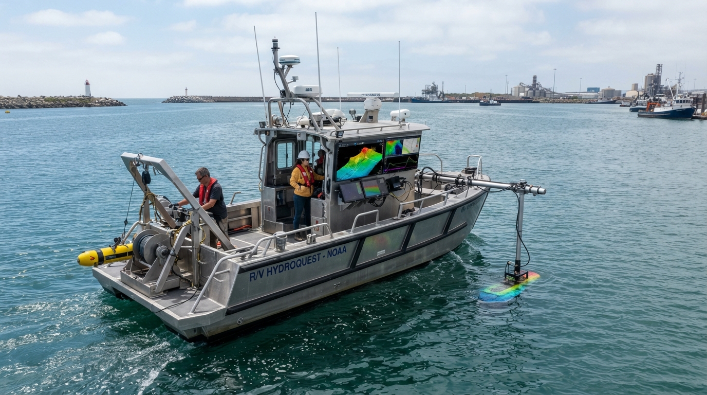

Hydrographic Survey is the process of collecting data about underwater environments. It measures water depth, seabed topography, underwater structures, currents, tides, and other marine conditions to support safe navigation and engineering projects.
The collected data is processed to create accurate bathymetric charts, seabed models, and marine maps used by engineers, hydrographers, and government agencies worldwide.
Why is Hydrographic Survey Important?

Hydrographic surveys provide reliable information for:
- Safe marine navigation
- Port and harbor development
- Offshore oil and gas projects
- Wind farm construction
- Dredging operations
- Coastal protection
- Bridge and pipeline construction

- Environmental monitoring
- Flood management
- Marine scientific research

Major Hydrographic Survey Equipment
Survey Vessel
A specially equipped boat that carries hydrographic survey instruments.
Uncrewed Surface Vessel (USV)
An autonomous or remotely operated survey platform used in shallow or hazardous waters.
Multibeam Echo Sounder (MBES)
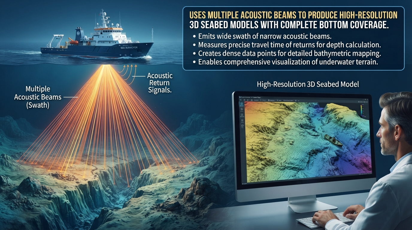
Produces high-resolution 3D bathymetric maps by measuring thousands of depth points simultaneously.
Single Beam Echo Sounder (SBES)
Measures water depth directly beneath the survey vessel.
Side Scan Sonar (SSS)
Creates detailed images of the seabed to detect rocks, pipelines, cables, wrecks, and other underwater objects.
Acoustic Doppler Current Profiler (ADCP)
Measures water current speed and direction throughout the water column.
Sound Velocity Profiler (SVP)
Measures the speed of sound in water to improve sonar accuracy.
Tide Gauge
Records tidal variations for accurate depth corrections.
GNSS / RTK Positioning
Provides precise positioning of the survey vessel and survey equipment.
Hydrographic Survey Applications
Bathymetric Mapping
Port Development
Harbor Maintenance
Offshore Wind Farms
Offshore Oil & Gas
Pipeline Route Survey
Cable Route Survey
Dredging Survey
Coastal Engineering
Bridge Construction
Environmental
Monitoring
Navigation Chart Production
Underwater Inspection
Hydrographic Survey Workflow
Project Planning
Equipment Mobilization
Sensor Calibration
GNSS Positioning Setup
Data Acquisition
Tide Observation
Sound Velocity
Measurement
Quality Control
Data Processing
Bathymetric Mapping
Final Survey Report
Learn Hydrographic Survey at MBH Geosphere
MBH Geosphere provides educational resources covering hydrographic survey fundamentals, modern survey technologies, equipment operation, data processing, and real-world engineering applications. Whether you are a student, surveyor, or engineering professional, our goal is to help you understand hydrographic surveying through simple explanations and practical knowledge.
