
RTK Rover Set
Achieving Centimeter-Level Positioning in Real Time

An RTK Rover Set is a high-precision GNSS surveying system designed to determine accurate positions in real time. It receives correction data from an RTK Base Station or a CORS network, allowing surveyors to achieve 1–3 cm accuracy. RTK Rover Sets are widely used in land surveying, construction, GIS mapping, hydrographic surveying, mining, agriculture, and infrastructure projects.
What is an RTK Rover Set?
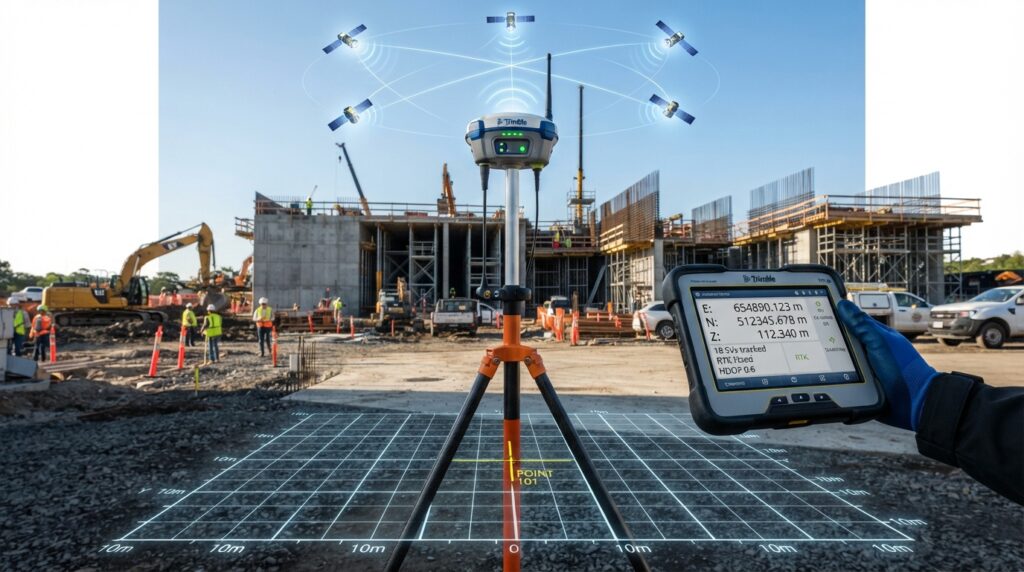
An RTK Rover Set consists of a GNSS receiver, controller, survey pole, and communication system. It receives correction data from a Base Station or CORS network and instantly calculates highly accurate coordinates for field measurements.
Unlike a standalone GPS receiver, an RTK Rover provides real-time centimeter-level positioning, making it ideal for engineering and surveying applications.
Main Components
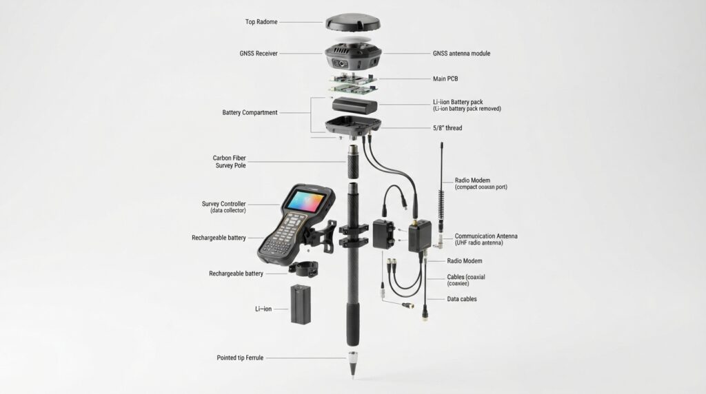
GNSS Receiver
Tracks multiple satellite constellations and receives correction data.
Survey Controller
A handheld device used to control the survey and collect field data.
Survey Pole
Provides a stable platform for the GNSS receiver.
Communication Module
Receives corrections through UHF Radio, GSM, or NTRIP.
Battery
Supplies continuous power for field operations.
How Does an RTK Rover Work?
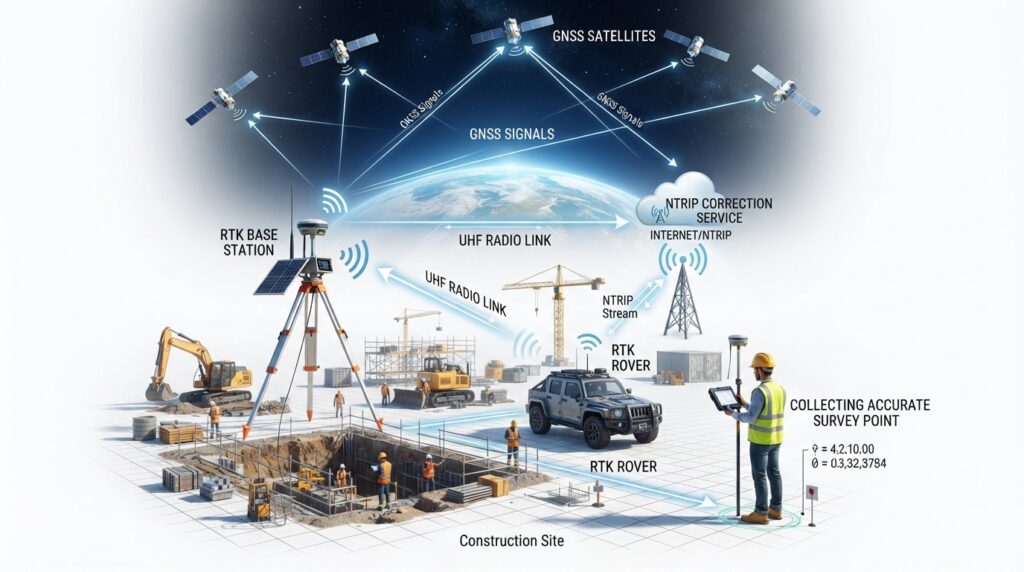
tep 1
Receives satellite signals from GPS, GLONASS, Galileo, and BeiDou.
Step 2
Receives correction data from the Base Station or CORS.
Step 3
Applies RTK corrections in real time.
Step 4
Calculates centimeter-level coordinates.
Step 5
Stores survey points in the controller.
Types of RTK Rover Sets
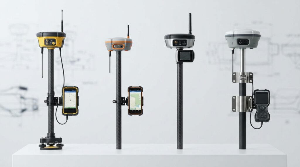
Standard RTK Rover
Designed for general land surveying and mapping.
Network RTK Rover
Receives corrections directly from a CORS network via the internet.
Integrated Rover
Combines GNSS receiver and controller into one compact device.
Marine RTK Rover
Designed for hydrographic and marine positioning applications.
Frequently Asked Questions
What is an RTK Rover Set?
A survey-grade GNSS positioning system that receives correction data to provide real-time centimeter-level accuracy.
Can an RTK Rover work without a Base Station?
Yes, if it connects to a CORS network using NTRIP. Otherwise, it normally requires a local RTK Base Station.
What is the typical RTK accuracy?
Approximately 1–2 cm horizontal and 2–3 cm vertical, depending on conditions and equipment.
Which industries use RTK Rover Sets?
Surveying, construction, hydrography, GIS, mining, agriculture, utilities, transportation, and infrastructure development.
Conclusion
The RTK Rover Set is an essential tool for modern surveying professionals. By combining GNSS technology with RTK corrections from a Base Station or CORS network, it delivers fast, reliable, and centimeter-level positioning for a wide range of engineering and geospatial applications. It is a cornerstone of today’s high-precision surveying workflows.