About MBH Geosphere
Engineering Survey Knowledge Hub
Building Knowledge for Survey Engineers Around the World
Every successful engineering project starts with accurate information. Whether it is constructing a highway, designing a bridge, developing a port, or mapping the seabed, reliable survey data is always the first step.
MBH Geosphere was created to help people understand the technologies and methods used to collect that information.
We are an educational knowledge hub that focuses on survey engineering. Our goal is to explain technical topics in a simple and practical way so that students, beginners, and professionals can learn with confidence.
Instead of using difficult engineering language, we explain every topic step by step with real-world examples, diagrams, and easy-to-understand illustrations.
Our Mission
Our mission is simple.
We want to make survey engineering knowledge easy for everyone.
Many websites explain survey equipment and survey methods using complex technical language that is difficult for beginners to understand. MBH Geosphere follows a different approach.
Every article is written in clear English with practical explanations that help readers understand not only what a technology is, but also why it is used and how it works in real projects.
Our aim is to help people learn useful engineering knowledge that they can apply in education, fieldwork, and professional careers.
Our Vision
Our vision is to become one of the most trusted online learning platforms for survey engineering.
We want MBH Geosphere to be a place where students, engineers, researchers, and survey professionals can find reliable information in one location.
As the website grows, we will continue adding new educational resources, technical guides, practical examples, illustrations, and industry updates to support lifelong learning.
What We Cover
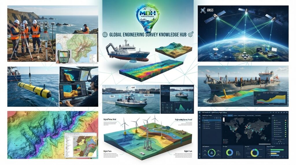
MBH Geosphere focuses on the main areas of survey engineering that are widely used in civil engineering, marine engineering, offshore construction, mining, infrastructure development, and environmental projects.
Land Survey
Our Land Survey section explains the equipment and techniques used to measure and map land. Topics include Total Stations, GNSS, RTK GPS, Level Surveys, Topographic Surveys, Control Surveys, Survey Software, and field procedures.
Hydrographic Survey
Hydrographic Survey is one of the main sections of MBH Geosphere. Here you can learn about Survey Vessels, Uncrewed Surface Vessels (USVs), Multibeam Echo Sounders, Single Beam Echo Sounders, ADCP, Side Scan Sonar, Tide Gauges, Sub Bottom Profilers, and hydrographic data processing.
Geophysical Survey
The Geophysical Survey section explains how engineers investigate what lies beneath the seabed. It includes Marine Magnetometers, Seismic Surveys, Sub Bottom Profilers, and other technologies used in offshore and marine projects.
Dredging Survey
Our Dredging Survey section covers the complete dredging process, from planning to project completion. You can learn about Pre-Dredge Surveys, Progress Surveys, Post-Dredge Surveys, Dredging Equipment, Volume Calculations, Cutter Suction Dredgers, Trailing Suction Hopper Dredgers, Backhoe Dredgers, and modern dredging techniques.
Why MBH Geosphere Is Different
Many engineering websites only provide basic definitions or highly technical information.
At MBH Geosphere, we focus on practical learning.
Every article is written with the reader in mind. We explain technical topics using simple language, real project examples, professional illustrations, and step-by-step explanations that are easy to follow.
Our goal is not just to define survey equipment but to help readers understand how it is used in real engineering projects.
Our Commitment to Quality
We believe that good educational content should be accurate, useful, and easy to understand.
Before publishing any article, we carefully review the technical information and organize it into a simple learning format.
As survey technology continues to evolve, we regularly review and improve our content so readers always have access to updated information.
Who Can Learn from MBH Geosphere?
MBH Geosphere is designed for anyone who wants to learn about survey engineering.
Our content is suitable for university students, fresh graduates, survey technicians, civil engineers, hydrographic surveyors, marine engineers, geophysicists, GIS professionals, offshore contractors, dredging engineers, researchers, educators, and anyone interested in engineering surveys.
Whether you are learning for the first time or improving your professional knowledge, MBH Geosphere is built to support your learning journey.
Our Learning Approach
We believe that learning becomes easier when complex topics are explained in a simple way.
That is why every article on MBH Geosphere follows a structured format.
We start with the basic concept, explain how the technology works, describe its main components, show where it is used, discuss its advantages and limitations, answer common questions, and include educational illustrations wherever possible.
This approach helps readers build knowledge step by step without feeling overwhelmed.
Looking Ahead
MBH Geosphere is a growing knowledge platform.
In the future, we plan to expand our educational resources by adding more engineering articles, technical illustrations, practical guides, video tutorials, comparison charts, and industry updates.
Our goal is to create a complete learning resource that supports engineers and students throughout their careers.
Thank You
Thank you for visiting MBH Geosphere.
We appreciate your interest in survey engineering and hope our educational resources help you learn new skills, build your technical knowledge, and better understand the technologies used in modern engineering projects.
We look forward to being part of your learning journey.